Maps of the Nile
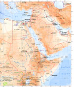
Someone scanned and emailed this
map to
me, its the best one by far. My thanks to them.
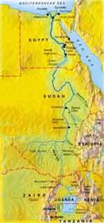
Modern map of the Nile.
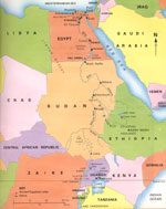
A clearer modern map of the nile
.
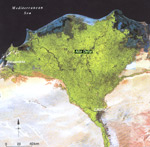
Satellite photo of the
nile River delta.
The black area at the top of the photo is the Mediterranean Sea.
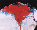
False color satellite image of the
nile Delta, Red
means Water, Blue means buildings, and white is desert.
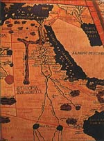
This is an ancient map drawn by Poltemy,
although old the map is surprisingly accurate.

Shows the height above sea level of the
nile at different points.
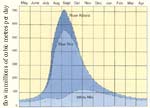
Shows the flowrate of the
nile at different times at the year
ـــــــــــــــــــ
A Fact File about the
nile River
Length: (From White
nile Source to Mouth) 6695km (4184 miles).
Name: The
nile gets its name from the Greek word "Nelios", meaning River Valley.
Sources: The White Nile: Lake Victoria, Uganda. The Blue Nile: Lake Tana, Ethiopia.
Countries: The
nile and its tributaries flow though nine countries. The White
nile flows though Uganda, Sudan, and Egypt. The Blue
nile starts in Ethiopia. Zaire, Kenya, Tanzanian, Rwanda, and Burundi all have tributaries, which flow into the
nile or into lake Victoria Nyanes.
Cities: The major cities that are located on the edge of the
nile and White
nile are: Cairo, Gondokoro, Khartoum, Aswan, Thebes/Luxor, Karnak, and the town of Alexandria lies near the Rozeta branch.
Major Dams: The major dams on the
nile are Roseires Dam, Sennar Dam, Aswan High Dam, and Owen Falls Dam.
Flow Rate: The
nile River's average discharge is about 300 million cubic metres per day. To get a more accurate idea about how much water actually flows in the
nile look at this image:
Atbara is the first town on the Nile, when no more smaller rivers join the
nile futher down it.
To find out where Atbara is have a look at the
maps
Cubic metres * 35.31 = cubic feet.
Cubic feet * 7.481 = USA gallons
600 cubic metres = 21,186 cubic feet.
21,186 cu.feet = 156,776.4 USA gallons.
If you need other conversion units:Click here
 Flow Direction:
I have recieved many emails about why does the
nile river flow south to north, the answer is very simple. The river just flows down hill, from the high mountains in the middle of africa to the
nile delta (point where
nile enters the Mediterranean Sea). Here is an image I scanned in from a book to show in more detail the way the
nile flows. Use this image with the
maps on the
maps page to find out where the places on this map are.
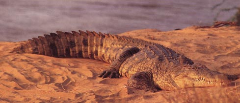
Crocodiles are very common along the banks of the
nile River.
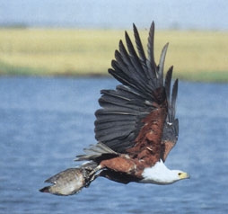
Fishing Eagles are a common bird along the Nile.
ــــــــــــــــــــــــــــــــــــــــــــــــــ ـــــــــــــــــــــــــ
Everyday millions of people commute on the River Nile. Here are some of the things that happen everyday on the Nile.
Tourism: Everyday there are numerous luxury cruisers, and traditional Egyptian sailing boats travelling up and down the Nile. These boats will drop you off at tourist attractions, so you can look at them, (but remember to get back onboard the boat in time or the boat will leave without you).
Farming: There are hundreds of farms along the Nile, and usually farmers use boats to transport items (such as rice, wheat, cattle, and hay) between locations on the Nile.
Fishing: Almost everyone who lives on the
nile would have done some fishing at one time in their life or another, and for some fishing is a main source of income and wealth. Each year thousands of tonnes of fish are caught.
A Hieroglphic showing a man hoeing the ground, with a woman behind him sowing the seeds.
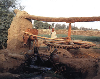
A man uses a cow to pump water on to his crops.

The Aswan High Dam, when it was build created Lake Nasser, Lake Nasser Streches back 270 kilometres from the Dam. The Lake has also created alot more land for people to farm on. This is because a lot of water is stored in the lake, and in turn this water can be used to irrigate land around the lake. Lake Nasser has also created a big fishing industry, which produces 25,000 tonnes of fish a year, the fishing industry is aiming to produce 100,000 tonnes by the year 2000.
Unfortunately this dam has caused a big change to the lifes of farmers downstream from the dam. Usually when the river flooded once a year before the dam was built. It deposited fertile soil from upstream on its banks downstream. This washed up soil was extremely furtile, and renewed itself every year at in flood season. But now, since the dam was built the annual flood has been stopped. Causing all the farmers downstream to have to use fertilizers to grow their crops, which makes it more expensive.
The Aswan High Dam is also used to create hydro-electricity for Egypt,
Quote from a book in my school library:: "in the 1980's this dam was providing half of Egypt's Electricity, but by the 1990's this had fallen as energy demands increased. The electric power capacity of the Aswan High Dam is: 2.1 gigawatts (GW). It consists of 12 Hydro-Generators each rated at 175 MW. Egypt currently has a total installed generating capacity of 16.6 gigawatts (GW) compared to 3.8 GW in 1976, thus the percentage contribution by the High dam has decreased from over half the total electricity generation to less than 13%. This percentage will continue to decrease as more thermal power plants are added. Total capacity expected to be 26 GW by 2010."
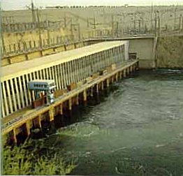

Some of the Hydroelectric Generators at Aswan High Dam.
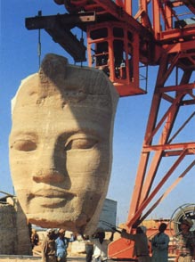
When the Aswan high dam was built, the entire Temple of Abu Simel was shifted, so it wouldn't be flooded and destroyed when Lake Nasser filled up.
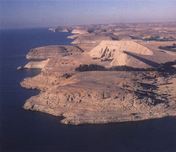
The temple is now located on the edge of Lake Nasser.

Cairo is located on the edge of the
nile River, near the spot were the river splits into two branches, at the delta. Cairo is Africa’s biggest city it has a population of 13 million and each day 5 million people travel to Cairo to work. Cairo is over populated, housing demands and transport services are under great strain. Cairo wasn’t designed to house so many millions of people, Cairo has also used up lots of good farming land, which could of been used to grow more crops, to feed its population, but instead factories and high-rise buildings have been build apon it. A great number of magnificent carved masonry domes, mausoleums, and mosques have been preserved in Cairo, principally in the old medieval areas.
Mosque of Mohammed Ali, Cairo, Egypt.
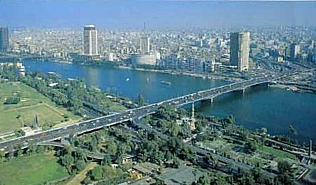
Cairo Today.
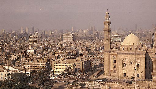
Another view of above photo.
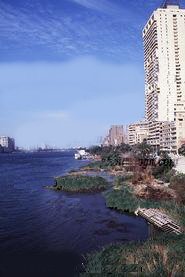
A building on the egde of the Nile
,
خريطة حديثة لنهر النيل.
خريطة أكثر وضوحا الحديثة من نهر النيل
الصورة .Satellite من دلتا نهر النيل.
المنطقة السوداء في الجزء العلوي من الصورة هو البحر الأبيض المتوسط.
صورة الأقمار الصناعية اللون كاذبة من دلتا النيل، الأحمر
يعني الماء، الأزرق يعني المباني، والأبيض هو الصحراء.
هذا هو مخطط القديمة التي Poltemy تعادل
على الرغم من العمر خريطة دقيقة بشكل مدهش.
يدل على الارتفاع فوق مستوى سطح البحر لنهر النيل عند نقاط مختلفة.
يظهر معدل التدفق لنهر النيل في أوقات مختلفة في العام
ملف الحقائق حول نهر النيل
الطول: (من الأبيض المصدر النيل إلى الفم) 6695km (4184 ميل).
الاسم: النيل يحصل على اسمها من الكلمة اليونانية "Nelios"، وهذا يعني وادي نهر.
مصادر: النيل الأبيض: بحيرة فيكتوريا في أوغندا. النيل الأزرق: بحيرة تانا في إثيوبيا.
بلدان هي: النيل وروافده تتدفق على الرغم من تسعة بلدان. يتدفق النيل الأبيض على الرغم من أوغندا والسودان ومصر. يبدأ النيل الأزرق في إثيوبيا. زائير وكينيا وتنزانيا ورواندا وبوروندي جميعا الروافد التي تصب في نهر النيل أو إلى بحيرة فيكتوريا Nyanes.
المدن: المدن الرئيسية التي تقع على حافة نهر النيل النيل والأبيض هي: القاهرة، غندكرو، الخرطوم، أسوان، طيبة / الأقصر، معبد الكرنك، ومدينة الإسكندرية تقع بالقرب من فرع Rozeta.
سدود رئيسية هي: السدود الكبرى على نهر النيل هي سد الروصيرص وسنار السد، السد العالي، وأوين سد شلالات.
معدل التدفق: متوسط تصريف نهر النيل حوالي 300 مليون متر مكعب يوميا. للحصول على فكرة أكثر دقة حول كمية المياه تتدفق بالفعل في نظرة النيل في هذه الصورة:
عطبرة هي أول مدينة على نهر النيل، عندما تنضم توجد أنهار أكثر أصغر النيل futher أسفل ذلك.
لمعرفة أين عطبرة هو إلقاء نظرة على الخرائط
متر مكعب * 35.31 = قدم مكعب.
قدم مكعب * 7.481 = الولايات المتحدة الأمريكية جالون
600 متر مكعب = 21186 قدم مكعب.
21186 cu.feet = 156،776.4 غالون الولايات المتحدة الأمريكية.
إذا كنت بحاجة إلى وحدات التحويل الأخرى: اضغط هنا
اتجاه التدفق:
لقد تلقى العديد من رسائل البريد الإلكتروني حول لماذا تدفق نهر النيل الجنوب إلى الشمال، والجواب بسيط جدا. النهر يتدفق فقط إلى أسفل التل، من الجبال العالية في وسط أفريقيا إلى دلتا النيل (النقطة التي يدخل النيل في البحر الأبيض المتوسط). هنا هو صورة مسحت في من كتاب لإظهار بمزيد من التفصيل الطريقة يتدفق النيل. استخدام هذه الصورة مع الخرائط في صفحة الخرائط لمعرفة أين الأماكن على هذه الخريطة هي.
التماسيح شائعة جدا على طول ضفاف نهر النيل.
النسور الصيد والطيور مشترك على طول نهر النيل.
الملايين من الناس اليومية تخفيف على نهر النيل. وفيما يلي بعض الأشياء التي تحدث كل يوم على النيل.
السياحة: كل يوم هناك العديد من سفينة سياحية فخمة، والقوارب الشراعية التقليدية المصري يسافر إلى أعلى وأسفل نهر النيل. وهذه القوارب إسقاط قبالة لكم في مناطق الجذب السياحي، لذلك يمكنك أن ننظر إليها، (ولكن تذكر أن نعود على متن قارب في الوقت المناسب أو سوف القارب ترك دون لكم).
الزراعة: هناك المئات من المزارع على طول نهر النيل، وعادة ما يستخدم المزارعون قوارب لنقل وحدات (مثل الأرز والقمح والماشية، والقش) بين المواقع على نهر النيل.
الصيد: أن الجميع تقريبا الذي يعيش على ضفاف النيل قد فعلت بعض الصيد في وقت واحد في حياتهم أو لآخر، وبالنسبة لبعض الصيد هو المصدر الرئيسي للدخل والثروة. واشتعلت كل عام آلاف طن من الأسماك.
وHieroglphic تظهر رجلا العزق الأرض، مع امرأة وراءه بذر البذور.
يستخدم رجل بقرة لضخ المياه إلى محصوله.
السد العالي في أسوان، عندما كان بناء خلق بحيرة ناصر، وبحيرة ناصر ستركس الظهر 270 كيلومترا من السد. خلقت بحيرة أيضا المزيد من الكثير الأرض للناس لالزراعي يوم. هذا هو لأنه يتم تخزين كميات كبيرة من المياه في البحيرة، وبالتالي هذه المياه يمكن أن تستخدم في ري الأراضي حول البحيرة. خلقت بحيرة ناصر أيضا لصناعة صيد الأسماك الكبيرة، التي تنتج 25000 طن من الأسماك سنويا، وصناعة صيد الأسماك تهدف لإنتاج 100،000 طن بحلول عام 2000.
للأسف تسبب هذا السد تغييرا كبيرا ليفس المزارعين المصب من السد. عادة عندما غمرت النهر مرة واحدة في العام قبل بناء السد. بإيداع والتربة الخصبة من المنبع على ضفافه المصب. وكانت هذه جرفتها الامواج التربة furtile للغاية، وجددت نفسها في كل عام في في موسم الفيضان. ولكن الآن، تم إيقاف منذ تم بناء السد الفيضان السنوي. مما تسبب في كل المزارعين المصب لديك لاستخدام الأسمدة لزراعة محاصيلهم، مما يجعله أكثر تكلفة.
يستخدم السد العالي في أسوان أيضا لخلق الكهرباء المائية لمصر،
. اقتباس من الكتاب في مكتبة مدرستي :: "في عام 1980 هذا السد كانت تزود نصف الكهرباء في مصر، ولكن بحلول عام 1990 كان قد سقط هذا مع زيادة الطلب على الطاقة والقدرة والطاقة الكهربائية من السد العالي في أسوان هي: 2.1 جيجاوات (GW )، ويتكون من 12 المائية مولدات كل صنف في 175 ميغاواط. مصر لديها حاليا ما مجموعه قدرة التوليد من 16.6 جيجاوات مقارنة مع 3.8 غيغاواط في عام 1976، انخفض بالتالي نسبة مساهمة كتبها السد العالي من أكثر من نصف إجمالي توليد الكهرباء إلى أقل من 13٪. وسوف تستمر هذه النسبة في الانخفاض كما يتم إضافة محطات الطاقة الحرارية أكثر سعة مجموع يتوقع أن يكون 26 غيغاواط بحلول عام 2010. "
بعض المولدات الكهرومائية في السد العالي بأسوان.
عندما تم بناء السد العالي في أسوان، تم نقل معبد كامل أبو سيميل، لذلك لن يكون غمرت ودمرت عندما شغل في بحيرة ناصر يصل.
يقع المعبد الآن على حافة بحيرة ناصر.
يقع القاهرة على حافة نهر النيل، بالقرب من بقعة كانت الانقسامات النهر إلى فرعين، في الدلتا. القاهرة هي أكبر مدينة في افريقيا ويبلغ عدد سكانها 13 مليون نسمة، وكل يوم 5 ملايين شخص يسافر إلى القاهرة للعمل. القاهرة قد انتهت بالسكان، مطالب الإسكان وخدمات النقل تحت ضغط كبير. تم القاهرة ليست مصممة لاستيعاب ملايين كثيرة من الناس، وقد استخدمت القاهرة أيضا الكثير من الأراضي الزراعية الجيدة، والتي يمكن من استخدمت لزراعة المزيد من المحاصيل، لإطعام سكانها، ولكن بدلا من المصانع والمباني الشاهقة وكان بناء apon ذلك. وقد تم الحفاظ على عدد كبير من القباب الرائعة المنحوتة البناء والأضرحة والمساجد في القاهرة، لا سيما في المناطق القديمة في العصور الوسطى.
مسجد محمد علي، القاهرة، مصر.
القاهرة اليوم.

